Colorful visual representation of a world map

Coverage Map Now Supports Sharing & Coordinates

I just released a minor update to the coverage map.

  • Sharable map links are now available
  • Users can now enter locations using coordinates (format as signed decimal degrees; e.g., 38.897700, -77.036500)

The new share options appear in two places. From the main user interface, you can click the share icon to get a link that captures features of your current view (e.g., the map’s center, the color scheme, the selected network and technology). There’s also a share button visible after selecting a specific hex. Links generated with that button direct to a map centered on the selected hex with a pin marking the location.

I’d like to offer my thanks to Reddit user redi20 for the suggestion to add support for coordinates.

Much larger map updates will be coming shortly!

Image representing Earth from space

RIP Dead Zones?

Today, Verizon and AST SpaceMobile announced a partnership. All three of the largest US networks now have plans to reduce dead zones with the help of cell signals transmitted from constellations of satellites. AT&T has been publicly working alongside SpaceMobile for a while, but the company only locked in a formal deal earlier this month. For now, T-Mobile is the exclusive US-based network planning to provide cellular connectivity with SpaceX’s Starlink satellites.

Early Days

I don’t expect either AST or SpaceX’s service to become widely available in 2024. When satellite connectivity eventually becomes available for normal consumers, it’ll likely be limited to subscribers on premium, high-cost plans.

Texting First

The excerpt below comes from CNET’s article about the recent announcement from Verizon and AST:

T-Mobile’s deal with Starlink is exclusive to the carrier in the US, and while there is no timeline for when it will launch for users, the carrier says it plans to start with text messaging when it does go live, before expanding to support voice and data in the future. AST SpaceMobile says that its satellite broadband service supports video, voice and data.
While I don’t think anything is technically incorrect there, I expect all direct-to-cell satellite services will center around text messages at first. Each satellite will initially provide coverage for a huge area (i.e., many thousands of square miles). Bandwidth constraints will lead companies to focus on activities that aren’t data intensive. Providing texting connectivity for thousands of people is far more valuable than allowing one person in a remote area to stream a video.

100% Coverage?

With today’s announcements, there was talk about eliminating dead zones with “100 Percent Geographical Coverage of the Continental United States”. It’s perhaps over-optimistic. Dead zones will still exist in buildings. Areas with canyons, dense tree cover, or other objects blocking the sky might continue to have coverage issues. And satellites will do almost nothing to solve congestion issues which, when severe, can make areas effectively dead zones. Still, it’s super exciting. I’ll be following closely.

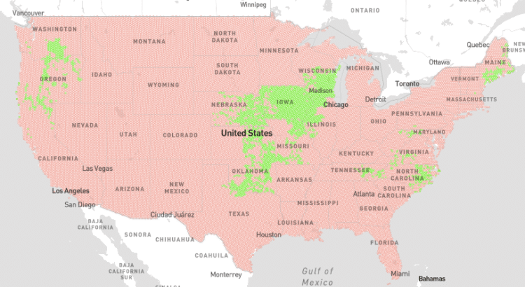
US Cellular coverage map screenshot

T-Mobile Plans To Buy Most Of U.S. Cellular

T-Mobile plans to buy U.S. Cellular’s almost 5 million subscribers, all of U.S. Cellular’s stores, and some of U.S. Cellular’s spectrum. The deal is expected to close in mid-2025 and will likely involve a final price between 4 and 5 billion dollars.

While I’m often not a fan of consolidation in the wireless industry, the writing has been on the wall for U.S. Cellular. The deal still needs to make it past regulators, but I don’t expect major hurdles getting in the way of approval.

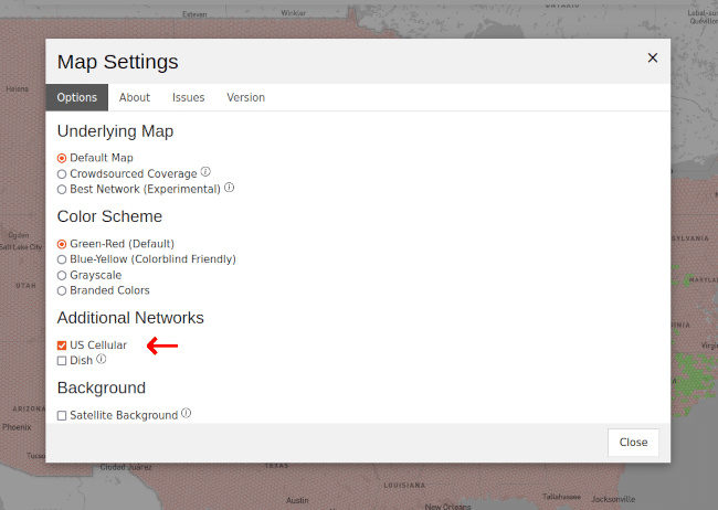
While U.S. Cellular and T-Mobile’s networks remain distinct, I’ll continue to offer a map of U.S. Cellular’s coverage that’s accessible from the coverage map’s settings menu.

Screenshot from the coverage map showing an option to add U.S. Cellular as an additional network